Rejoice, fellow wanderers of the wood — we have new mappage!
Now, those who follow the map reviews on this little site are likely familiar with Bryan Conant‘s San Raf maps, though I’ve only (until now) reviewed the 2008 and 2013 editions of his excellent Matilija and Dick Smith Wilderness map. But now I’m happy to report we have a third edition of the San Rafael Wilderness map — and so finally, a review!
What’s New … and What’s Changed
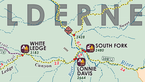
First, the usual suspects: a new fold, new aesthetics, mileages have been refined, route numbers have been added, the shading indicating the wilderness area(s) is a much lighter — and better, IMHO — green, and the Zaca Fire (2007) perimeter has been removed. Seven years on, I suppose the changes that fire ushered into our forest is a part of the landscape now anyway. The map still shows the La Brea (2009) Fire perimeter.
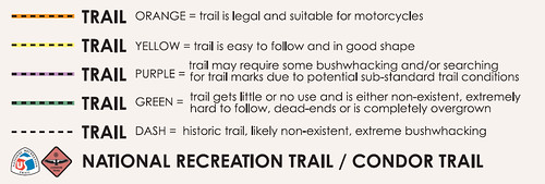
As with the 2013 Dick Smith map, the route the Condor Trail will follow/follows is marked with the CT icon. As a CT supporter, I just love this.
Also as with the 2013 Dick Smith map, one of my favorite little additions to this new map are points of interest and historic sites (what we in the dungeons like to call “diamonds in the rough“), rendered in small caps and violet. This is such a great addition to his newer maps! Rightly, he doesn’t include all of the historic camps that once stretched across what is now the San Raf, but he sure nails most of the interesting ones (and exercises some real tact in those he chooses to exclude, for those wondering). I would love for historical lookouts and/or guard stations to be marked in this way in a future edition (but that’s just me getting my carto-nerd on).
Some camps listed are those only recently removed from any official inventory: Coche Camp, which the RSO and I enjoyed during 2011’s Riddler trek; Hiawatha; Hog Pen Spring; and Cachuma (which it turns out may — or may not — be on somebody else’s property).
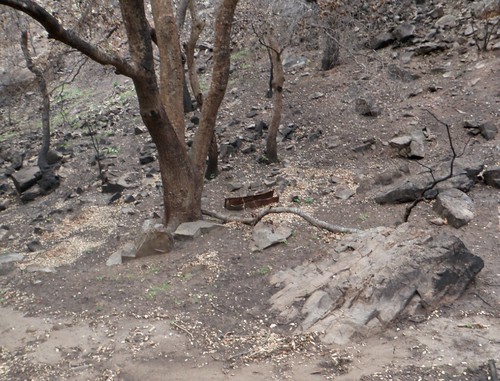
Ice Can Stove at the Old Hiawatha Site | Spring 2011 | Image courtesy Bryan Conant
Some of these “diamonds in the rough” that are of particular interest are the Fall Canyon sites above the Sisquoc Condor Sanctuary and a handful of the old sites in the Buckhorn drainage … sites just begging for additional recon. And while (as mentioned above) most of the sites Mr. Conant has chosen to not mention are for good reason, one I rather wish he’d included is the old Branch Canyon camp in that exclave out in the South Cuyama Oil Field. It’s long-since razed of course — despite many online maps (incl. Google) marking it — but anything that draws attention to that corner and our inability to access the old Lion Canyon trailhead via Perkins Road is something I’ll get behind (see now in the comments section some articulate “back in my day” comment from the Expat Eldon Walker; one cannot discuss Lion Canyon access without raising his ire).
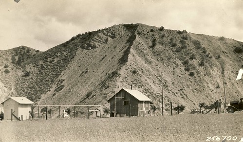
Branch Canyon Guard Station, Cuyama Ranger District | 1930s
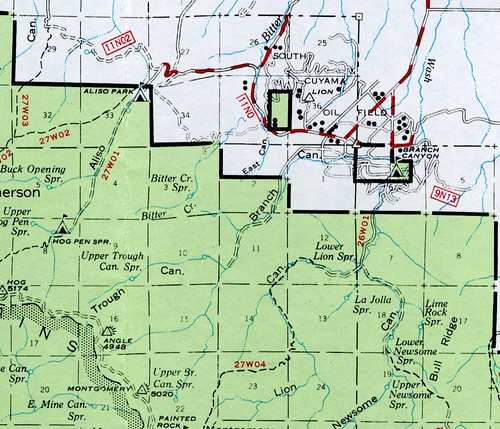
Branch Canyon | USFS 1967 Visitor’s Map
Another that I would like to see in this new “wayback” category is the Santa Barbara Potrero camp/Sierra Madre guard station, if only because its existence is near and dear to my heart.
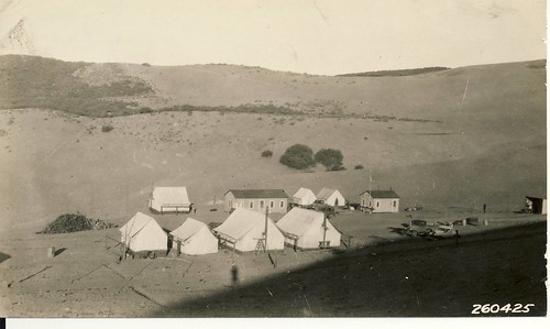
Santa Barbara Potrero and Sierra Madre Station | 1931
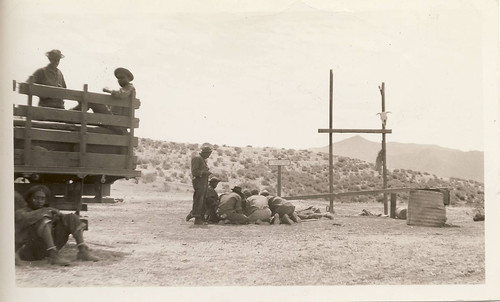
CCC Crew 2925-C at Santa Barbara Potrero | 1938
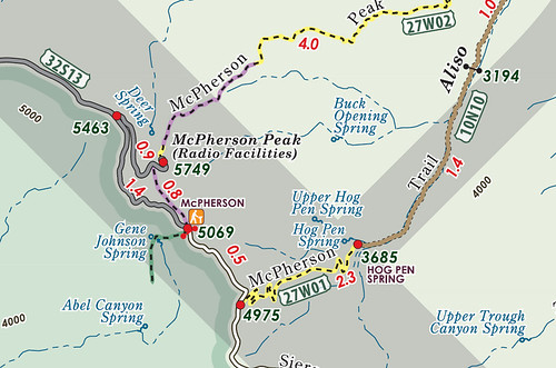
One that was there, gone, and is now back again (in “historical” form) is McPherson Camp. McPherson appeared on the original 2003 San Raf maps, but did not appear in the 2007 second edition. While not a great site by any stretch of the imagination, it’s still useable and so I’m glad to see it at least mentioned in some form here.
And whilst the historical features are great notes for we curious folk who spend way too much time down in the weeds, we also see a handful of “new” (to the map, anyway) routes that have been added for this edition: the Gifford Trail, the “new” camp at the Mono Narrows, the work camp along the Alamar upstream from Bill Faris (note also the spring once shown at Bill Faris camp? No longer.), and Kellogg camp along the Santa Cruz NRT. The Caliente TH has been removed, whilst Ray’s, Lorna, Horseshoe Bend camps, and a handful of attractions in the lower SYRA have been added. Too, the route heading southwest from Grassy Mountain toward Midland School’s various trails is also now shown.
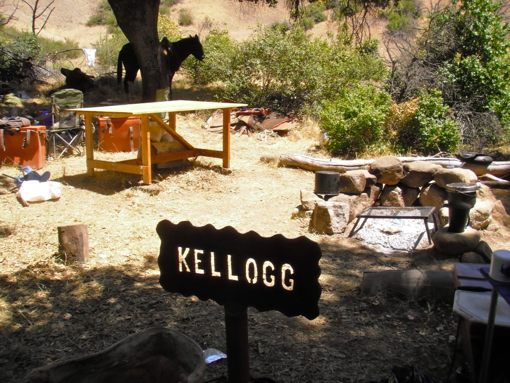
Kellogg Camp | Spring 2013 | Image courtesy Cowboy Clark
The new camps included though do remind us that some existing camps still need some love if they’re to remain on future maps (e.g., hazard trees at Bill Faris). As much of the work on the Los Padres these days is done by volunteers, another great aspect of the new San Raf map is the section Conant allocates to singing the praises of — and trying to recruit — Volunteer Wilderness Rangers.
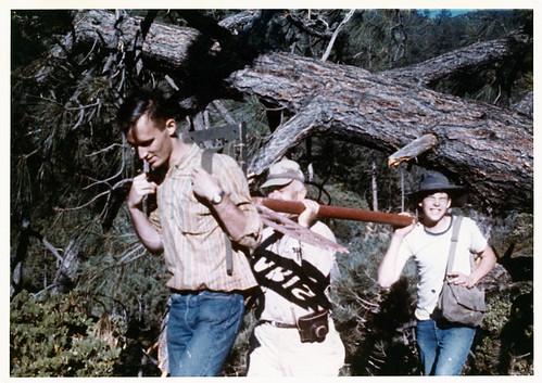
George Hardie, George Guntermann, and Wayne Moore Carrying the Bill Faris Sign to Camp | June 1962 | Image courtesy Robert Burtness
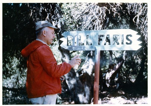
George Guntermann Painting Installed Sign | June 1962 | Image courtesy Robert Burtness
Also with this edition comes a new level of “thick”: non-colored lines indicating historical or genuinely hopeless routes (The Caracole, anyone?). This will either prove super-cool or a super-big headache to SB County SAR.
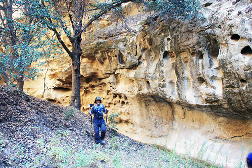
The Expat along the Salisbury Canyon Trail (rated green by Conant) | Fall 2013
Minor tweaks across the board, of course, e.g., the White Oaks Fire Station (abandoned and then burned in the 2009 La Brea fire) no longer makes an appearance, and the inholding just west of Kendall Spring adjacent to Cox Canyon has been removed from the map: the Wilderness Land Trust bought said property from the Hvolboll family in 2011 and then passed it on to the Forest Service. (I guess we’ll just wait and see if the next Los Padres visitor’s map makes the same correction.)
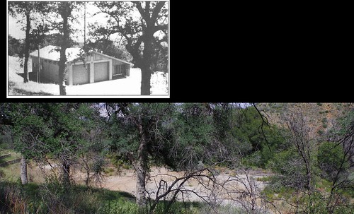
White Oaks Fire Station site | 1967 and 2014
The site formerly known as “Indian Creek” (Dick Smith Wilderness) on Conant’s map is now “Indian Canyon,” with which I agree.
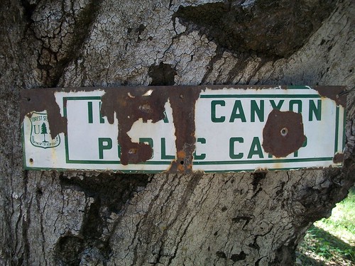
Indian Canyon Camp | Winter 2011
One typo worth pointing out is McKinley Mountain v McKinley Peak (correct on the map proper, not so much on the inset). Small potatoes.
The Nitty
Sometimes I think these map reviews should have a section just to laud eagle-eyed tweaks. To his credit, Conant also takes the time to correct tiny errors that have appeared on USFS and other maps for generations. “Gene Johnson” camp or “Johnson” Spring? No, those are Johnston, thank you kindly. “Roma” Potrero? It’s appeared that way on maps since World War II, but historians and the rangers back in the day maintain it is actually Romo Potrero. Frijol Flat, adjusted. The McKinley Spring v Cold Spring naming kerfuffle, handled.
Credit to a cartographer who concedes even his folk — with their mapping superpowers — can get it wrong (and then takes the trouble to correct such legacy errors).
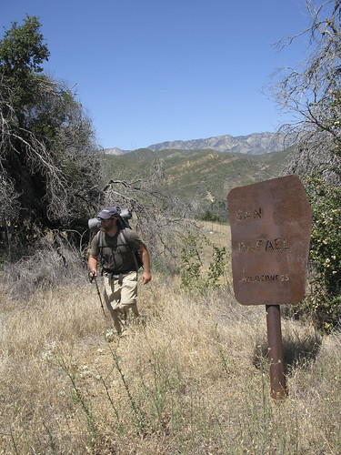
Entering Romo Potrero | Summer 2011 | Image courtesy the RSO
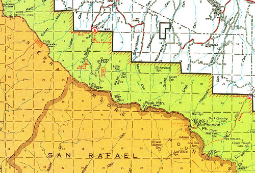
“Johnson Spring” and Long List of Things Since Fallen Off the Map | USFS 1974 Visitor’s Map
Price has increased from $8.95 to $10.95, on par with the Matilija and Dick Smith. While you don’t get the value-add of the other map’s verso, it’s still absolutely worth it. Bear in mind however one thing: the UPC code on the back of the map will scan at $22.50. Whilst Mr. Conant is distributing stickers to address this issue, because the map ships shrink-wrapped (and that wrapping might be removed by window-shopper or folks only looking for one piece of intel), not all retail copies may sport the correct code. Be mindful at check-out that you are not over-charged.
So whilst the San Rafael Wilderness is the wilderness of those in the southern Los Padres in which I spend the least time, I am happy to have this new guide in my side pocket, ready to be rained upon, baked, torn, and worn into near-illegibility as have its mighty predecessors.
(Oh, and before anybody asks: yes, Kirschenmann Road is spelled correctly.) 😉
TO THE SAN RAF!


Leave a Reply