“21! Read ’em and weep, boys.”
Continuing now our discussion of trails by Range number (see the conversation about trail- and road-naming conventions for more on the specifics), we find ourselves at Series 21 West.
(Refer to Series 18 West, Series 19 West, and Series 20 West for the earlier installments.)
21W01
Pleito Creek
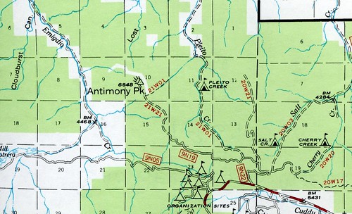
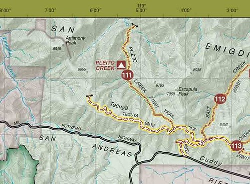
For years this was the “sneaky” way in to KER-77, even after access was closed. Now it’s gated by a metal barrier about three and a half miles from Cuddy Valley Road. In its 4WD route form (Trail 111), it’s a fairly rough road … but when there aren’t any Jeeps or raised Blazers bouncing up this route, it’s a beautiful walk, and the campground about half-way along is a nice one under mixed conifer and oak shade with a table, fire ring, water … the works.
I do think however it’s a bit over-rated as a 4WD route … USFS ratings mark it a black diamond, but that seems to me a trifle dramatic. This isn’t the Rubicon Trail, and I venture to guess a skilled driver could get up there in a 2WD PreRunner-style Tacoma with no modifications. (Sorry for the tangent.)
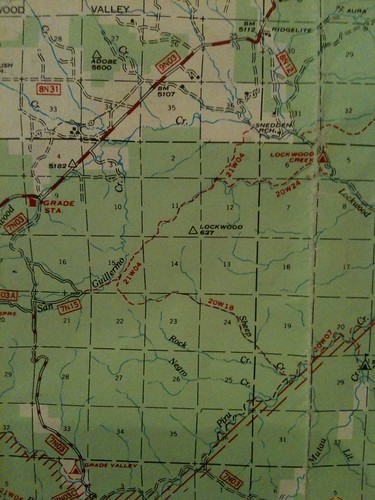
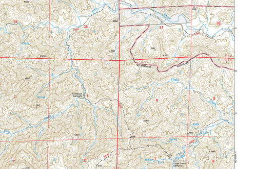
The 1967 visitor’s map excerpt shown above also has a non-contiguous section of the trail coming down the NE slopes of Antimony Peak. For this I cannot account. Would it be petty for me to point out the typo on the 2011 MPRD MVO Map? Yes? Okay, then I’ll provide the excerpt and not say anything:
21W02
McGill Trail
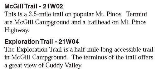
A beautiful and easy drop from McGill campground down to the Y along Cuddy Valley Road (or a steady climb north-to-south). Popular with mountain bikers (and formerly with skiers, judging from the old blazes), this is a great hike along the lower north slopes of Mt Pinos.
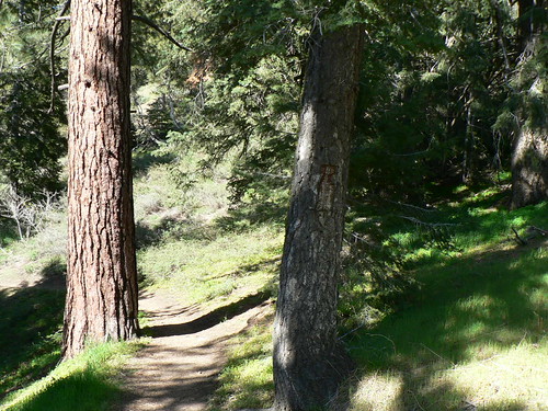
Blazes! McGill Trail, Spring 2011.
21W03
Vincent Tumamait Trail/Pinos-Abel Trail
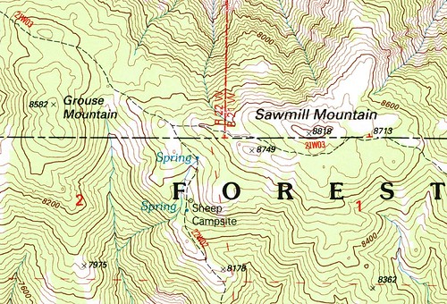
My second home. The 21W03 is the highest route in the Los Padres, bar none. In about six trail miles one can bag four peaks over 8,000′ (Pinos, Sawmill, Grouse, and Mt Abel/Cerro Noroeste), never dipping below 7,500′. It forms the top of the Chumash Wilderness’s roughly pi-shaped trio of trails, one leading down to Sheep Camp and Lily Meadows, the other to Mesa Spring and the San Emigdio Mesa.
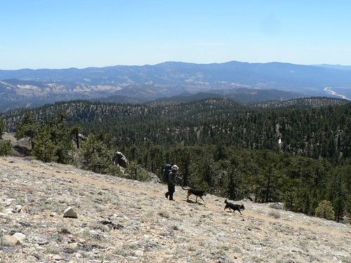
The RSO and pack descending Pinos, Spring 2012
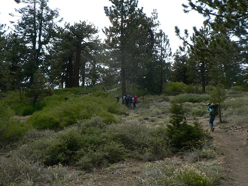
Troop 284 at the North Fork/Tumamait Junction, Spring 2012
21W04
Exploration Trail (or not)
The USFS maintains (at present, anyway) that the 21W04 is the nice trail that circumnavigates McGill campground. (I believe it’s the only ADA-compliant route in the southern districts, but haven’t verified.) It’s a nice stroll for the wee ones, and has some giant sequoias that were planted here in the 1970s as part of a forestry experiment. I’d accept that on proximity alone; Range-wise it’s a match and it’s tucked between *02 and *03 well enough.
But as discussed in our Series 20 West conversation this past September, the 1968 and 1969 LPNF visitor maps used the 21W04 label on the Yellowjacket Trail out in Grade Valley (of course, Yellowjacket’s designation is almost a running joke, so let’s not dwell overly).
21W05
Fishbowls
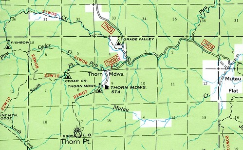
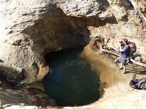
Naturally, we can’t just rifle through this with any form of cartographic clarity … mais non! When we arrive upon Grade Valley/Mutau/Fishbowls/Cedar Creek it all goes to Hell’s Half-Acre in a hand basket.
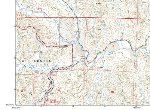
The current (2008) USFS visitor maps show the Fishbowls route as 22W05, whilst the USDA website labels it as part of 22W10 loop (I assume they mean 21W10, but the MPRD is infamously bad at providing accurate web content, so let’s skip this for now, since on other USDA sites it’s listed as 21W10 … sometimes you just can’t win). But legacy maps all the way up to the infamous 1995 series (including the USFS’s recent vector digitization of the 1995 series, which I’ll use below for illustrative purposes) list the Fishbowl route (both incarnations, either the original starting from the corrals or the “new” route from the former Grade Valley campground-cum-Fishbowls TH) as 21W05.

Fishbowls Trail sign at Camp, Fall 1984. Image courtesy and © The Los Padres Expat
21W06
(North Fork?) Cedar Creek
Adding to the confusion with regard to the Fishbowls route/loop/etc. above is the fact there were once two Cedar Creek routes; the one we know and love these days (meeting with the Pine Mountain Lodge connector at its high point), but also a lower route that cut southeast much sooner after leaving Fishbowls and following a more direct route along the north fork of Cedar Creek. See the 1967 excerpt in the 21W05 entry, above.
The old map(s) showed the North Fork to be 21W06, and the upper loop to be 22W10, further muddying the waters and lending some credence to why current ranger districts still can’t get it straight. Then of course the 1995 maps showed up and used the 21W06 label for the upper loop, but only from the PML junction down to the road (seriously, you can’t make this stuff up).
21W07
Thorn Point
Like the resolute lookout itself, at least the label on this tried-and-true route has remained dependable throughout the ages.
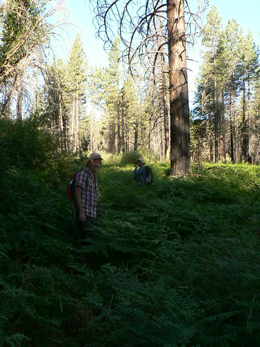
PVH and the RSO, Fern-bound. Summer 2012.
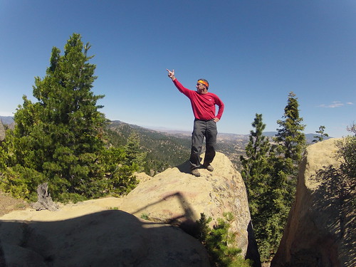
Bardlero Primero, Patron Saint of the 20W15, along the Thorn Point trail. Summer 2012.
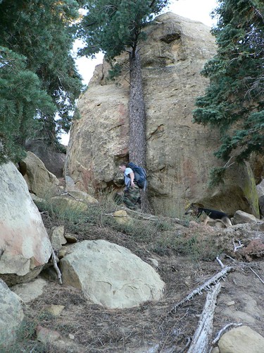
Herr Weßen and the uber-hund along 21W07, Fall 2010.
21W08
Red Reef
One of the greatest stretches of trail in the Forest, the Red Reef route cuts from the Red Reef/Sespe confluence up the Red Reef and Timber drainages beneath the shadow of Hines Peak. Atop Nordhoff Ridge, it then traverses the old Navy road before dropping into Sisar Canyon to connect with the Sisar Road. The RSO rightly ranks this as possibly the greatest route of the 2009–2011 research exploratories. High praise indeed.
The 21W08 got a major re-working in the summer of 2011 after the Day Fire (2006) wrecked huge stretches of the trail. The C.R.E.W. — with an assist here and there from the CCC — re-routed some of the most damaged sections, and it’s now a veritable highway of wilderness wonder. Go get some.
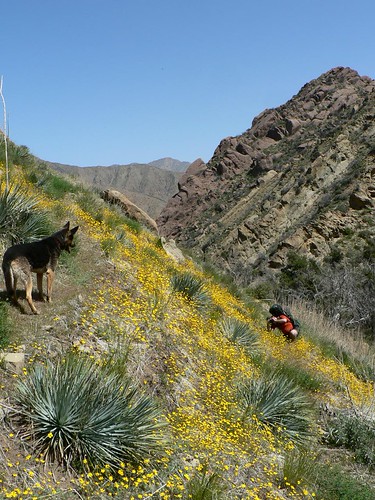
The uber-hund and the RSO along the 21W08, Spring 2010.
21W09
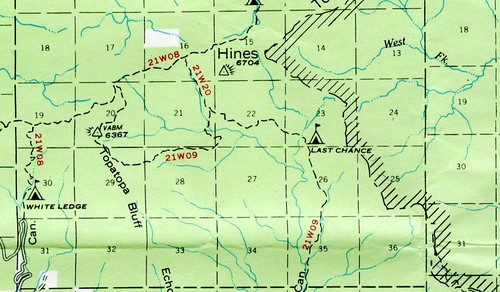
Santa Paula Canyon (Last Chance Fork)
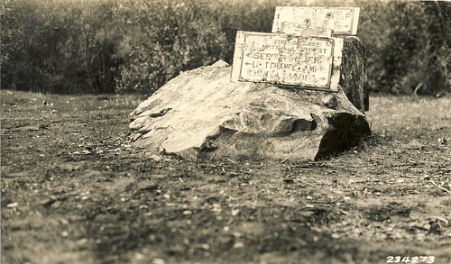
Santa Paula Canyon Signage, 1928. Image courtesy LPNF Archives.
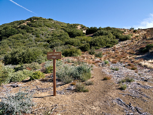
Don Borad trailhead atop 23W09, Fall 2011. Image courtesy and © the Los Padres Expat.
Another great and (almost infamous) route in the Santa Paula/Ojai frontcountry, starting at Thomas Aquinas and ending atop Nordhoff Ridge just east of Elder camp, by way of Topatopa Bluff. Several camps (and on the lower stretches, a whole lot of graffiti) line the route.

Jackson Falls, Winter 2009. Image courtesy and © Roy Ubu.
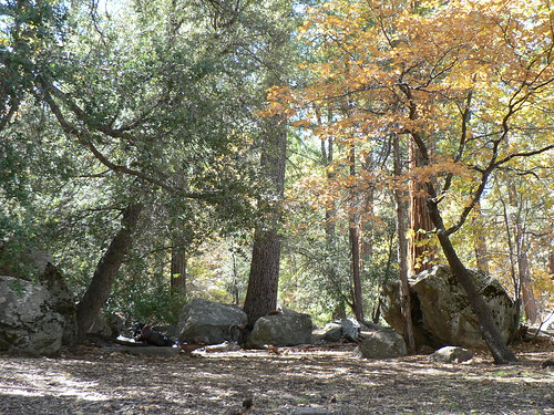
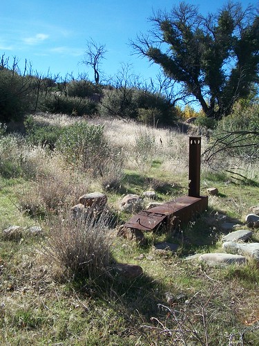
In the upper reaches of the canyon, the compact and rather sad Last Chance camp was abandoned by the Forest Service in the 1970s, but began to reappear on maps in the 1990s, and has maintained a steady cartographic presence since. Another site abandoned in the 1970s fiscal crunch was Topatopa Lodge, which made a fleeting appearance in the 1969 visitor map. It also still stands.
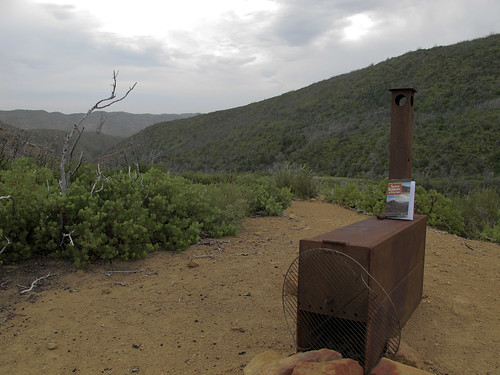
Blatant and shameful product placement amongst the ice cans at Topatopa Lodge, Summer 2012. Image courtesy and © the RSO.
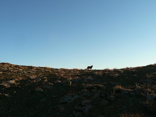
The uber-hund atop the Bluffs, Fall 2010.
21W10
Cedar Creek
Part of that Grade Valley bramble, this might be the trail leading from the PML junction down into Cedar Creek and Road 7N03C.
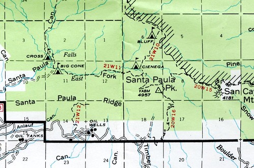
But then there’s the 1967 visitor’s map, insisting it’s the segment of trail between Cienega and Bluff camps.
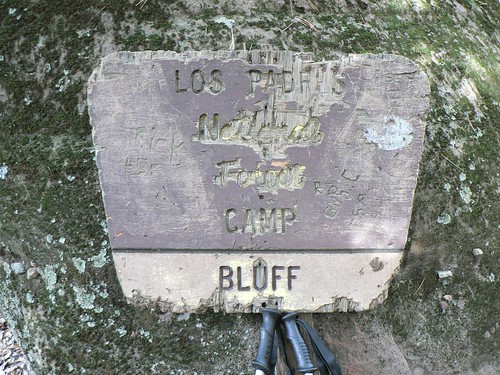
Bluff Camp Signage, Winter 2011.
21W11
Santa Paula Canyon (East Fork)
This much we know is true: the 21W11 is the East Fork. The route was wiped out in the late 70s floods, and hopelessly hammered again in 2005, but is still genuinely one of the most beautiful stretches of our fair forest. The RSO and I did the Santa Paula Trifecta in the Winter of 2011 … and whilst his favorite may be the Red Reef trek, I daresay this was mine. It’s lush, it’s empty, and it’s awesome. A quick look at the FRAP Wildfire Perimeter map shows a few tiny spots in our local backcountry that’ve not been burned since 1950, and this pocket of verdant wonder is one of them.
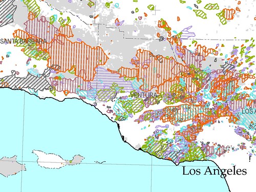
Wildfire Perimeters, 1950–2008.
See that bare gray spot above the “RA” in “VENTURA”? That’s Cienega and Bluff; spared every time since either the Matilija (1932) or perhaps Wheeler Springs (1948) Fire.
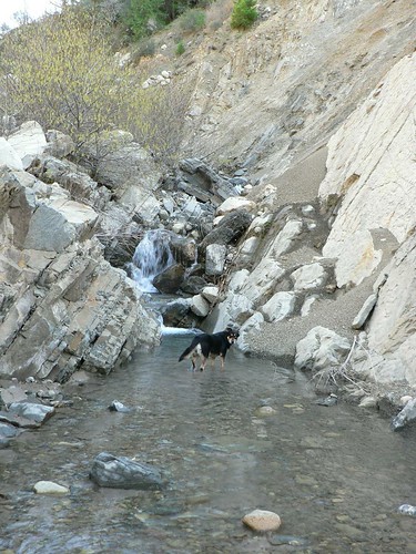
Mad-Eye, Doubtful. East Fork SP Canyon, Winter 2011.
21W12
W Fork Mud Creek Canyon/Santa Paula Ridge Trail
Not much beta or on-the-ground intel with regard to this route. But of course there are plans afoot, dear reader.
21W20
Last Chance Connector
This route cutting between No-Name and Hines Peak has throughout the years been mistakenly referred to (and labeled) the upper stretch of the Last Chance trail, but it’s actually always been the connector.
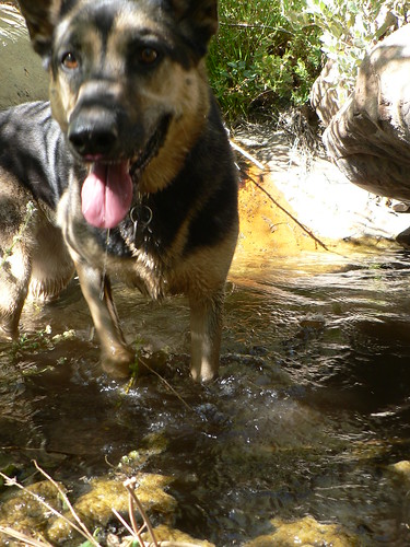
The uber-hund, happy to find water along the Last Chance Connector. Fall 2010.
21W21
Antimony Peak
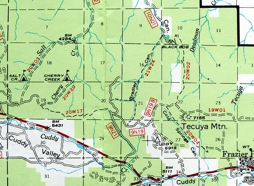
All the way back to the San Andreas Rift Zone, this route doubles as Forest Road 9N19, but now stops far short of the peak.
21W24
Bradley Canyon
Finally, and again in the northern reaches of the MPRD, we have the 21W24. I cannot help but think this was some cartographic error, as this route by all rights must surely be a 20W-series route at its western-most.
Leftovers
Again I am left a bit perplexed as to the chasm between the contiguous labels (1–12) and *20, *21, and *24. Might there have been others to fill in that empty space? Let us ponder.
Timber Canyon
One of those routes (and camps) abandoned in 1974, and one of the earliest posts I made on this site.
In the long-ago post, I discussed the cartographic legacy of the site, but in the associated graphic (below), the very short route in never held a trail number. Could it be one of the 21W series?
Well, in 1904 when trails were being built, Santa Barbara National Forest rangers set up camp at a Timber Creek site (the other Timber Creek being too far east, based on the description). Might the below be an image of a 21W spike camp?

“Ranger’s camp at head of Timber Creek H.Q. while building trail. Sec. 10, T. 5, R21W. Santa Barbara National Forest, Calif. Ventura Co.” U.S. Forest Service photo courtesy of the Forest History Society, Durham, N.C.
The Section (“Sec. 10”) mentioned places the site slightly too far upstream, but looking at the maps (see below), the site was always plotted a bit further south than it actually was (nor is the “head” of Timber Creek located there, and I would be hard-pressed to accept this as Horsethief). These minor details may account for the caption not quite synching.
Topatopa Peak Trail
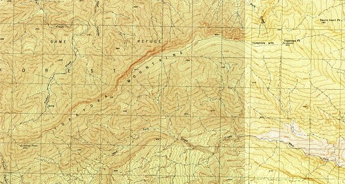
The route from Santa Paula Canyon (Last Chance Fork) to Topatopa Peak, as shown on the 1944 War Department Topatopa Mountains and Devils Heart Peak 7.5′ quads.
Here, then, is really the holy grail of any 21W pondering. By the time the visitor’s maps started showing the trail designations (1967, as best I can tell), the Topatopa Peak route was eight years lost to the Sespe Condor Sanctuary. (See the “Lookout!” entry here for details re: the lookout tower). The 1944 War Department quads (see above) show the route, and my copy of the only other maps that show the route on a properly-detailed map of any usable scale (the BLM cadastral maps) doesn’t show a number, nor did the 1981 Lancaster 1:100000 include trail numbers.
In the Fall of 2012, local backcountry explorer David Stillman busted brush along the ridgeline from Hines all the way to the site of the old lookout; a portion of his epi– sorry, I mean “entertaining” — route would have followed the old trail (see his TR here).
The 21W is rough country, but some of the best.

![Topotopa [sic] Lodge](http://farm9.staticflickr.com/8211/8289915501_a3f75cdf17.jpg)

Leave a Reply