Welcome to the end of the Los Padres
Time now for our conversation of some routes less-traveled, paths long-forgotten, and those footpath superhighways some of us typically avoid.
This discourse isn’t a dossier detailing every route in the southern Los Padres of course, but rather more of an inventory. And we’re going to be grouping them by Range, ie, trail number prefixes. (See our conversation about trail- and road-naming conventions from last September for more on those.)
We’ll start with the 18W trails.
The 18 West is one of the smallest groups of (remaining) trails in the Forest, largely due to the fact the Los Padres boundary ends in Range 18 West and as such there isn’t much room to work with … the Angeles NF picks up directly east of here and footpaths are few as one reads a map from that boundary toward the Interstate (and by then you’re in Range 17 West). Further, more than half of the routes have been abandoned in the last half-century or so. Pickings are slim.
But what we do have are a handful of pretty iconic (and somewhat infamous) routes.
18W01
Buck Creek/White Mountain/Upper Cobblestone
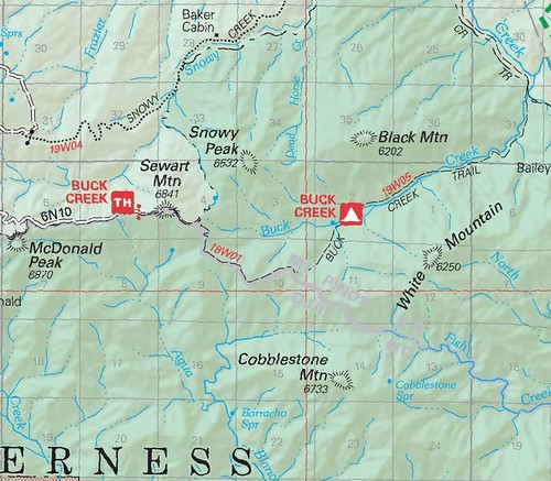
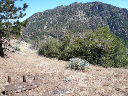
Yes, right away we run into a problem. The current (2008) LPNF visitor map shows 18W01 as the short stretch of trail leading from the Buck Creek trailhead via Sewart Mountain to (one assumes) the split with the old White Mountain/Cobblestone Mountain route at the pond:
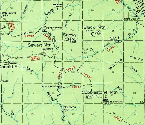
Yet older maps (eg, my beloved 1967 visitor map) show 18W01 as being the length of the Buck Creek route after the pond (nearly the complete opposite):
Now as many of you are aware, I tend to defer to the older maps on most issues, but this stretch of the Forest has long been the subject of cartographic conundrum and marker misplacements. Even the Harrison maps differ on some points in this corner, making the Buck Creek area something of a mapmaker’s Bermuda Triangle. ZK, DMuse and I explored the Buck Creek route in the summer of 2011 (see the whole sweltering affair here) and pondered this very issue whilst standing amidst the crispy Coulters atop Sewart Mountain. And I’ve still no definitive answer.
18W02*
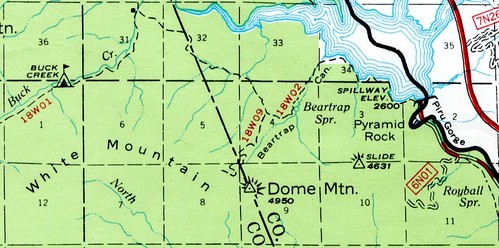
The Bailey/Beartrap Route
What’s that you say? Why yes, this is another Beartrap route out there (well, actually two more, but we’ll get to that later) … the lovely trail camp (formerly camps) along the north slopes of Pine Mountain had a namesake doppelganger here at the far east end of the Forest for several decades. This route has long-since been abandoned.
Once easily accessed from the stretch of US Route 99 now submerged beneath Pyramid Lake, the old route is typically now only approached by boaters enjoying the Beartrap picnic area administered by the California Department of Water Resources on behalf of the Angeles National Forest (who administers this portion of Forest on behalf of the Los Padres National Forest … I know, I know…).
The Bailey portion of 18W02 still appears on federal maps, but has pretty much been reduced to an afterthought (or game trail) at best.
18W03
Cobblestone Trail
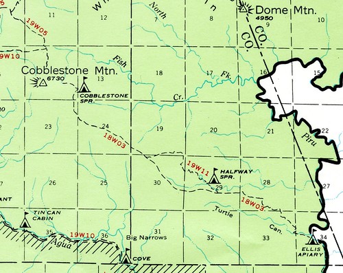
Oh, sweet Cobblestone. That route that has vexed raconteurs, expats, and other rovers of the Forest fair since time immemorial. This route was abandoned by the Forest Service in the 1960s, but some of its trail camps appear on maps as recently as the 1995 Cobblestone Mountain 7.5′ quad (doing something of a disservice to some Forest-goers perhaps, but also providing fuel to others’ fires).
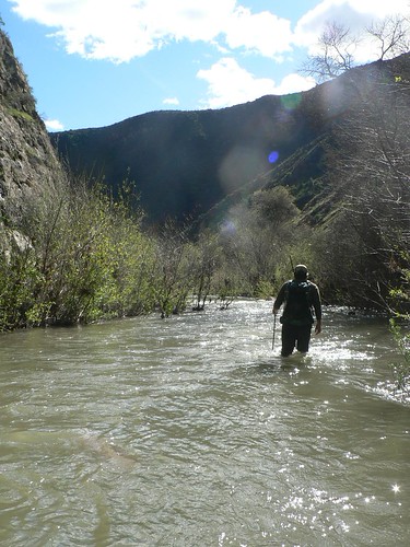
The lower portion is still viable (just), and Nico and I enjoyed a high-water excursion from Temescal Station to Ellis Apiary in February 2011.
18W04
Pothole Trail
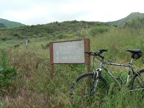
This route is well-known to eastern county hikers, and one that receives dedicated care from Alan Coles and his intrepid band of volunteers. It’s also the eastern stretch of the Condor Trail.
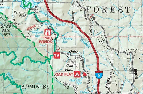
Another errata here, and one for which I have yet to fully account. Over along the old US99 where the Slide Mountain route climbs toward the Sespe Wilderness, the trail is also marked 18W04. Well hell.
After 18W04, we reach the boneyard. All these routes have been abandoned for decades … but beg some ambitious recon.
18W07*
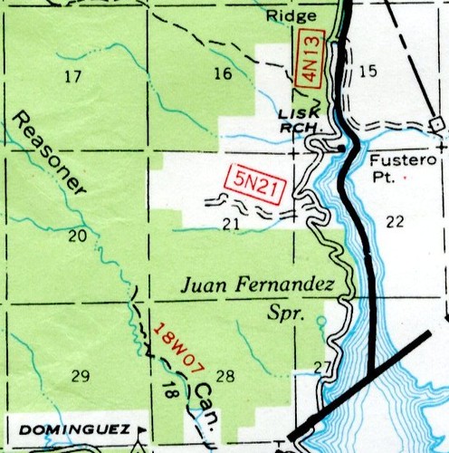
Reasoner Canyon
18W08*
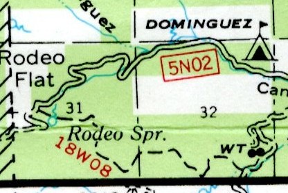
Rodeo Spring
18W09*
Upper Beartrap/White Mountain East
I don’t even know what to say here, other than “see you in the Spring.” (mwa triple ha)
18W10*
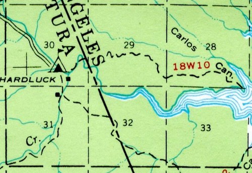
Carlos Ridge/Yellow Bar
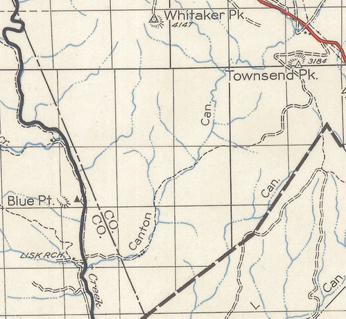
And what of the stragglers, specifically 18W05 and 18W06? Surely those of us in the crowd with continuity OCD (raises hand) note there’s a gap. Well, I haven’t quite settled that yet, but I do wonder what designation the old Canton Canyon route (shown below on the 1950 Los Padres visitor map) once held.
A route once descended from Townsend Peak Road (6N38) further southwest toward Lake Piru and was designated 17W05, but it’s conceivable — likely, even — the Canton route was part of the 18 West series. And small threads of trail (north of Dominguez Ranch, into Hopper Canyon, toward Arundell Peak) are all within the acceptable range and avail themselves to having once been in the 18W family.
Also consider the route shown on the 1944 Cobblestone 7.5′ quad, heading NW from Kesters Camp and tracing the ridgeline between the Agua Blanca and Piru/Turtle drainages. It “fell off” the maps by the time the 1958 revision was published, yet still leads one to wonder.
To be continued ….


Leave a Reply