Lookout! No. 6: Cuyama Peak

Sixth in a Series

Cuyama Peak

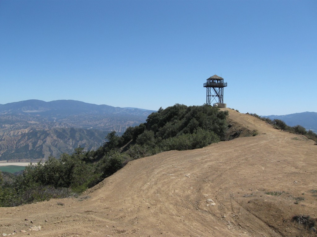
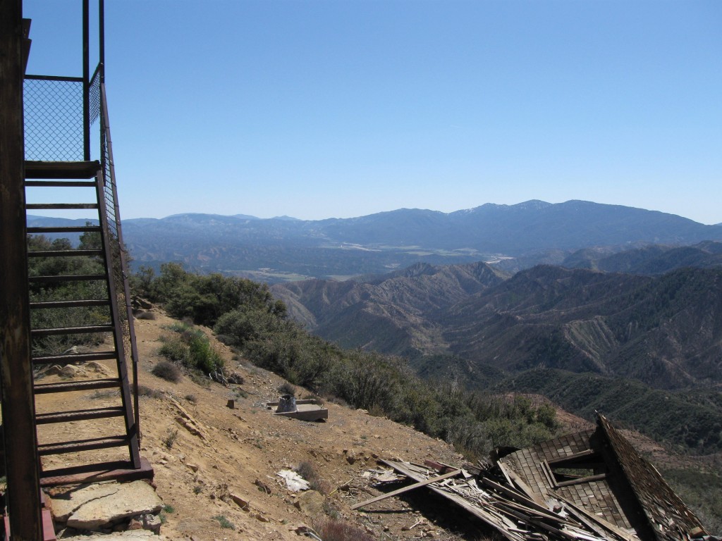
The Cuyama Peak lookout was erected in 1934, but — like the few lookouts still standing in the southern Los Padres — fell into disuse in the 1960s. Utilized by the AWS during WWII, the site’s cabin is still on the premises … barely. It’s collapsed in recent years and looks to be making a slow crawl down the slope. For the time being, it’s still recognizable as a cabin, and so for now we can consider it to be one of very few remaining in California. (Thorn Point features the only other one still standing in the southern districts.)

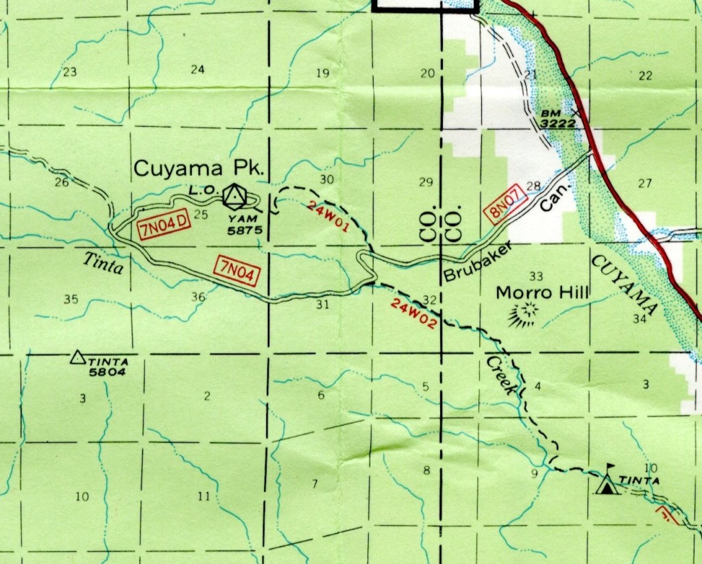
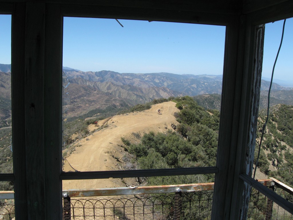
The cab typically remains open, and both it and the platform on which it stands still remain ideal vantage points for bird-watchers. Condors can on occasion be spied from here. And while the tower is vehicle-accessible via Dry Canyon, the road is not advised for passenger cars. As the drive up and into Santa Barbara Canyon is a fairly long approach for most, I’ve often wondered how it was back when the Forest Service still maintained (and had access to) the old Brubaker Trail (24W01).

Unlike Frazier Mountain and La Cumbre Peak, this lookout site isn’t cluttered by all the communications towers, dishes, and other distractions.

Just a lone lookout in a very lonely corner of the forest.

Peak images courtesy DSC.


Comments

9 responses to “Lookout! No. 6: Cuyama Peak”

  1. Lorinda Gail Poole Avatar
    Lorinda Gail Poole

    I appreciate so much those that take interest in the old towers and keep them alive for the future even if it is to be only through photography. A statement made in the article was that Cuyama Pk had fallen into disuse in the 1960’s. Perhaps there was a time that I am unaware of that the tower was closed, but I know that it was manned in 1970 as I was the person hired and lived part of my summer there until I needed to leave for winter employment in Taft. The Cuyama District FCO (Fire Control Officer) was Hurston Buck. He had transferred to the Cuyama District several years before. Prior to being on the Los Padres Forest he was FCO on the Stanislaus National Forest which borders Yosemite National Park. Hurston and his family were close friends with mine. My father, Ned Poole, was the law enforcement officer and worked under Hurston. I was raised on the Stanislaus and after my two year stay on the Los Padres I returned to my home forest and worked for both the California Dept. of Forestry and USFS for several years. Then I moved to the Payette National Forest in Idaho and manned two different lookouts there in addition to working part in the Chamberlin Basin of the Frank Church Wilderness. In 1971 I manned Thorn Point on the Mt. Pinos District. Just wanted to let you know that the tower was manned after the 60’s. I’m not sure, but something in the back of my mind tells me that I was the last to man Cuyama Pk., but that is not hard fact. I just have this little voice putting the thought of a possibility in mind. I remember the black bear that would come up onto the heliport which is the wide turn as you approach the tower and within just the first days there I killed a rattlesnake on the north side of the cabin. The biggest laugh is my “first fire report”. I had grown up around lookouts and that is why when Hurston was in need of a person to man the tower in the middle of the season that he brushed me up on my “ten code” and then took myself and my dog up the mountain and dropped us off. My first smoke I called in with an accurate location and being the valley I could see Hurston running “code 3” and he went right by my fire. I contacted him on the radio and told him that he had passed it. He turned around and went right by it again! Needless to say, there was NO fire. I was not used to valley country and when the sun would catch the large irrigation system sprinklers it looked like a light gray smoke. So the laugh was on me and I’m sure the rest of the forest had to be thinking, “Who in the world did Hurston put up on Cuyama Pk.” What a shame that it is all gone. Thank you again for posting your article and photographs.

    1. Lorinda, thanks so much for your contribution (and my apologies for taking so long to circle back to it). I recently came across some photos of Cuyama Peak from 1973, with staff … I will be interested to learn if you recognize anybody in them. Stay tuned! 🙂

      1. Lorinda Gail Poole Avatar
        Lorinda Gail Poole

        Well, it looks like my reply is as long coming as yours was….I would love to see some of the photos…so…I’ll “stay tuned” until the next millennium, ha!

        1. Lo and behold, here they are: http://www.craigrcarey.net/2014/05/return-cuyama-peak/

          Thanks Lorinda! 🙂

  2. Denise Dudley Avatar
    Denise Dudley

    Hi Craig. I have a question, and you look like someone who might have an answer! I was hoping to go from the old Sierra Madre road all the way to Hwy 33 on an adventure bike – but you talk about the Brubaker Canyon ‘trail’. So am I correct in assuming that the Brubaker canyon road disintegrates into a foot trail?
    Thanks!
    Denise

    1. Denise, I am interested in doing the same, maybe from McPherson Peak( Old Sierra Madre Road) to Cuyama Peak, . I just rode my dirtbike up to cuyama peak yesterday, and this Brubaker trail gate is locked. it looks like it would be a blast if we could get past the gate. hope it helps.

    2. The lower portion is private property, with no easement. So a route to the 33 would be best achieved following Tinta out to the Rancho Nuevo/Cuyama confluence. Very manageable. My real interest is in the old footpath that came off the top of Cuyama Peak, which now seems to have faded back into the brush.

      1. Michael Shields Avatar
        Michael Shields

        My recent attempts to find remnants of the old 24W01 footpath proved to be a challenge; I believe it has indeed been reclaimed by the brush. However there is a circular rock ring with a sawed off 4×4 protruding roughly 6″ out of the ground near the junction of where the old footpath originated off the Brubaker Cyn. road (8N07) I think it’s safe to assume this was the old trail marker. If your interested in tracking it down, the coordinates are as follows…34°44’47.26″N / 119°27’13.16″W (WGS84) My main interest was in Cuyama Peak, so I opted instead for running the top of the prominent ridge that goes northwest from this point all the way to the summit. Though steep in the bottom section, it is fairly manageable and lands you at the peak in 1.5 miles. Many of the peak-baggers utilize this route in lieu of a “summit by wheels” and it is fairly well marked with cairns along the way. Another interesting feature towards the top are the remaining communication poles (telegraph?) inclusive of insulators that were part of the lookout tower infrastructure. If your interested in any pictures shoot me an email.

        As always thanks for sharing the history Craig.

  3. Mike LeFevre Avatar
    Mike LeFevre

    I just stumbled on this site. I can add a little 1st hand history to Cuyama Peak Lookout for the years 1974-1978. During this time I lived at the nearby Forest Service Ozena Station. In 1974 I worked as a biologist mostly on Blunt-nosed Leopard Lizards in Ballinger Canyon. Cuyama Lookout was staffed by a young woman, Karen Allen. Since I had weird hours, I was available to take supplies up to her. Then on her days off we hung out some (both of us were college kids). I don’t remember any details from the 1975 season but I think the lookout was staffed. In 1976 the funding for my biology work ran out so they assigned me to be the Fire Prevention Patrol guy for the Fox Mountain Unit, which included Cuyama Peak. I was responsible for keeping the Cuyama folks happy. The lookout was staffed by a couple, Jim and Sue Black. He was a recovering drug addict (and pretty fried), and his wife was very religious. She would send me home with quotes from the Bible after I brought supplies. I drove the loop through Brubaker Canyon around to Santa Barbara Canyon almost every day. I had one spot under the only tree below the lookout where they could not see me or the truck (I took naps there more than once…). (I also patrolled the Sierra Madre to McPherson Peak and down to White Oaks Station). My duties expanded to cover more of the Mt. Pinos Ranger District for 1977 & 78. While I still lived at Ozena I did not have anything to do with the lookout. I think it was staffed but I don’t remember for sure. I am pretty sure the trail you talk about (24W01) originally followed the old telephone line (not telegraph). I vaguely remember the fire crew at Ozena used to still maintain the line in the 70’s. I think there was a crank phone at Ozena to call the Lookout.

    FYI I also met the infamous Hurston Buck (mention in a comment above). He had promoted to the Fire Control Officer for the entire Los Padres.

    It is very sad for me to see that the cab collapsed. Anyway, I moved on to the Sierra NF and then the Lake Tahoe Basin Mgmt Unit, 42 years after Ozena I retired from the Forest Service. Those were wild times for a fresh out of collage kid and I have lots of stories of things you cannot do in the Forest Service anymore!

Leave a Reply

Your email address will not be published. Required fields are marked *